


‘All right!’ said Pippin. ‘I will follow you into every bog and ditch. But it is hard! I had counted on passing the Golden Perch at Stock before sundown. The best beer in the Eastfarthing, or used to be: it is a long time since I tasted it.’
- The Fellowship of the Ring (Book 1), Chapter 4
The town of Stock lies on the Stock-brook stream near the western banks of the Brandywine in the Eastfarthing of the Shire. It is home to the Golden Perch inn.


The people in the Marish were friendly with the Bucklanders, and the authority of the Master of the Hall (as the head of the Brandybuck family was called) was still acknowledged by the farmers between Stock and Rushey.
- The Fellowship of the Ring (Book 1), Chapter 5
Rushey is a village in the Eastfarthing, located south of Stock and north of Deephallow.

‘Short cuts make long delays,’ argued Pippin. ‘The country is rough round here, and there are bogs and all kinds of difficulties down in the Marish – I know the land in these parts.'
- The Fellowship of the Ring (Book 1), Chapter 4
The Marish is a farmland in the Eastfarthing between the villages of Stock and Rushey. A partially reclaimed marshland, it is very fertile yet difficult to traverse. A high banked causeway allows for safe passage through the area.


The Eastfarthing village of Willowbottom lies on the banks of the stream Thistle Brook just north of where it meets the Shirebourn.


Deephallow is a village on the south-eastern edge of both the Eastfarthing and the Shire itself. The village lies on the banks of the Brandywine, just north to where it meets the Shirebourn.


He charged the ranks of the goblins of Mount Gram in the Battle of the Green Fields, and knocked their king Golfimbul’s head clean off with a wooden club. It sailed a hundred yards through the air and went down a rabbit-hole, and in this way the battle was won and the game of Golf invented at the same moment.
- The Hobbit, Chapter 1
Greenfields is a village in the Northfarthing. In T.A. 2747, a hobbit militia under the leadership of Bandobras Took defeated a force of invading orcs from Mount Gram there.


Tookbank is a village in the Westfarthing just north-west of the town of Tuckborough.


Peregrin Took marries Diamond of Long Cleeve.
- Appendix B, The Tale of Years
Long Cleeve is a town in the Northfarthing and home to the North-tooks, a distant branch of the Took family.


But all accounts agree that Tobold Hornblower of Longbottom in the Southfarthing first grew the true pipe-weed in his gardens in the days of Isengrim the Second, about the year 1070 of Shire-reckoning. The best home-grown still comes from that district, especially the varieties now known as Longbottom Leaf, Old Toby, and Southern Star.
- The Fellowship of the Ring (Book 1), Prologue
Located at the southern end of the Southfarthing, the town of Longbottom is where the pipe-weed was first introduced to the Shire. The town remains famous for its pipe-weed production as Longbottom Leaf is one of the most popular and sought-after varieties of pipe-weed in all of Middle-earth.


My cousin Hal for one. He works for Mr. Boffin at Overhill and goes up to the Northfarthing for the hunting. He saw one.
- The Fellowship of the Ring (Book 1), Chapter 2
The Westfarthing village of Overhill lies on the northern feet of Hobbiton Hill.

‘Yes, it is Elves,’ said Frodo. ‘One can meet them sometimes in the Woody End. They don’t live in the Shire, but they wander into it in spring and autumn, out of their own lands away beyond the Tower Hills.
- The Fellowship of the Ring (Book 1), Chapter 3
Located in the Eastfarthing, the upland forest of Woody End contains the sources of the Stock-brook and the Thistle Brook, as well as the village of Woodhall which lies on its north-eastern edge. The forest is frequented by Elves in spring and autumn as it lies along the road connecting Lindon and Rivendell.

Besides Bree itself, there was Staddle on the other side of the hill, Combe in a deep valley a little further eastward, and Archet on the edge of the Chetwood. Lying round Bree-hill and the villages was a small country of fields and tamed woodland only a few miles broad.
- The Fellowship of the Ring (Book 1), Chapter 9
Located north-east of Bree-hill, Archet is one of the three smaller villages surrounding Bree. It lies north of the East Road and north-east of Combe at the southern edge of the Chetwood.


It’s in the family, as you might say. Why, my grand-dad, and my uncle Andy after him, him that was the Gaffer’s eldest brother, he had a rope-walk over by Tighfield many a year. And I put as fast a hitch over the stump as anyone could have done, in the Shire or out of it.
- The Two Towers (Book 4), Chapter 1
The town of Tighfield lies at the north-western edge of the Westfarthing. It is home to the Roper and Gamgee families.


1451 Elanor the Fair marries Fastred of Greenholm on the Far Downs.
- Appendix B, The Tale of Years
The Westfarthing village of Greenholm is located near the Far Downs at the western borders of the Shire.


Needlehole is a village on the northern edge of the Westfarthing. It lies on the banks of the Shire-water.


There’s a good few down south in Longbottom and by Sarn Ford, I hear; and some more lurking in the Woody End; and they’ve sheds at Waymeet.
- The Return of the King (Book 6), Chapter 8
Located at the meeting of several smaller roads with the Great East Road, Waymeet is a town east of Michel Delving in the Westfarthing.


Gamwich is a village in the north-western Westfarthing. It is the place of origin of the Gamwich family which later evolved into the Gamgee family.


It reminds me, somehow, of the old room in the Great Place of the Tooks away back in the Smials at Tuckborough: a huge place, where the furniture has never been moved or changed for generations. They say the Old Took lived in it year after year, while he and the room got older and shabbier together – and it has never been changed since he died, a century ago.
- The Two Towers (Book 3), Chapter 4
One of the oldest settlements in the Shire, Tuckborough lies in between the Green Hills in the Westfarthing. The town is home to the Great Smials, the ancestral seat of the Took family.


The town of Newbury lies at the north-eastern end of Buckland. It is protected from the Old Forest by the High Hay that runs along the town's eastern edge.


We aren’t allowed to send by it now, but they use the old Quick Post service, and keep special runners at different points. One came in from Whitfurrows last night with a “secret message”, and another took it on from here.
- The Return of the King (Book 6), Chapter 8
Whitfurrows is a village in the Eastfarthing between Frogmorton and the Brandywine Bridge.


Little Delving is a village north of Michel Delving in the north-eastern Westfarthing.


‘That,’ said Merry, pointing with his hand, ‘that is the line of the Withywindle. It comes down out of the Downs and flows south-west through the midst of the Forest to join the Brandywine below Haysend. We don’t want to go that way! The Withywindle valley is said to be the queerest part of the whole wood – the centre from which all the queerness comes, as it were.’
- The Fellowship of the Ring (Book 1), Chapter 6
The village of Haysend marks the southern end of Buckland where the Brandywine and the Withywindle meet. Its name stems from it lying at the end of the High Hay which protects Buckland from the dangers of the Old Forest.


Long ago Gorhendad Oldbuck, head of the Oldbuck family, one of the oldest in the Marish or indeed in the Shire, had crossed the river, which was the original boundary of the land eastwards. He built (and excavated) Brandy Hall, changed his name to Brandybuck, and settled down to become master of what was virtually a small independent country. His family grew and grew, and after his days continued to grow, until Brandy Hall occupied the whole of the low hill, and had three large front-doors, many side-doors, and about a hundred windows.
- The Fellowship of the Ring (Book 1), Chapter 5
Located in the centre of Buckland, Brandy Hall is the ancestral home of the Brandybucks. It was first established by Gorhendad Oldbuck around T.A. 2340 and steadily grew into of the largest smials in all of the Shire. It was also home to Frodo Baggins following the death of his parents until he was adopted by his cousin Bilbo and moved to Bag End in T.A. 2989.
Built into Buck Hill, the village of Bucklebury, the chief village of the region, lies at Brandy Hall's feet. The village is also the namesake of the nearby Bucklebury Ferry, which allows for safe passage across the Brandywine.


Indeed, even in the hilly regions and the older villages, such as Hobbiton or Tuckborough, or in the chief township of the Shire, Michel Delving on the White Downs, there were now many houses of wood, brick, or stone.
- The Fellowship of the Ring (Book 1), Prologue
The de-facto capital of the Shire, Michel Delving sits amongst the hills of the White Downs in the Westfarthing. Its mayor is the only official in the whole Shire.
Consisting mostly of above-ground houses, the town's most famous buildings include the Town Hole, the mayor's office, and Mathom-house, a museum. The hills around the village are littered with Lockholes, old storage tunnels.


Even in the Shire the rumour of the Barrow-wights of the Barrow-downs beyond the Forest had been heard. But it was not a tale that any hobbit liked to listen to, even by a comfortable fireside far away.
- The Fellowship of the Ring (Book 1), Chapter 7
The Barrow-downs are a series of hills between the Old Forest and Bree, crowned with burial mounds dating back to the First Age. Revered by the Northern Dúnedain, they buried many lords and kings there.
Following the split of the kingdom of Arnor, the Barrow-downs became part of the kingdom of Cardolan. After Cardolan's defeat at the hands of the Witch King, many Dúnedain fled there. After the Great Plague killed the remaining Dúnedain, the Witch King released evil spirits into the hills. Known as Barrow-wights, they have been haunting the area ever since.


Upon the shores of the Gulf of Lhûn the Elves built their havens, and named them Mithlond; and there they held many ships, for the harbourage was good. From the Grey Havens the Eldar ever and anon set sail, fleeing from the darkness of the days of Earth; for by the mercy of the Valar the Firstborn could still follow the Straight Road and return, if they would, to their kindred in Eressëa and Valinor beyond the encircling seas.
- The Silmarillion, Of the Rings of Power and the Third Age
Built at the very beginning of the Second Age, Mithlond is the largest Elven settlement west of the Misty Mountains. It is the de-facto capital of the Elven realm of Lindon and is ruled by Círdan the Shipwright, one of the oldest and wisest Elves in Middle-earth.
Its havens have played a vital role throughout the history of the Northern Realms, serving as a wharf for both Númenórean and Gondorian hosts that went on to crush the armies threatening the safety of the peoples of Eriador.
A mighty realm in its own right, the Elves of Lindon have helped fend off the armies of Sauron and the Witch King throughout the Second and Third Age. Lindon's strength is greatly diminished by the end of the Third Age however, as many of its inhabitants have left Middle-earth for Valinor. The harbours of Mithlond offer passage there and are the chief destination for all Elves that desire to return to their homeland.


After the end of the First Age the power and wealth of Khazad-dûm was much increased; for it was enriched by many people and much lore and craft when the ancient cities of Nogrod and Belegost in the Blue Mountains were ruined at the breaking of Thangorodrim.
- Appendix A, Durin’s Folk
Guarding one of the only passes over the Blue Mountains, the city of Nogrod was one of the first dwarven dwellings in Middle-earth. After prospering for much of the First Age, the city was heavily damaged in the War of Wrath. This led most of its remaining inhabitants to abandon the city in favor of Khazad-Dûm early in the Second Age.


But when Eärnur came to the Grey Havens there was joy and great wonder among both Elves and Men. So great in draught and so many were his ships that they could scarcely find harbourage, though both the Harlond and the Forlond also were filled; and from them descended an army of power, with munition and provision for a war of great kings.
- Appendix A, The Númenorean Kings
The haven of Harlond, located on the southern shores of the Gulf of Lhûn, is one of the three large Elven harbours in Lindon.


After the end of the First Age the power and wealth of Khazad-dûm was much increased; for it was enriched by many people and much lore and craft when the ancient cities of Nogrod and Belegost in the Blue Mountains were ruined at the breaking of Thangorodrim.
- Appendix A, Durin’s Folk
Guarding one of the only passes over the Blue Mountains, the city of Belegost was one of the first dwarven dwellings in Middle-earth. After prospering for much of the First Age, the city was heavily damaged in the War of Wrath. This led most of its remaining inhabitants to abandon the city in favor of Khazad-Dûm early in the Second Age.


When the waves consumed Beleriand and the regions around it after the War of Wrath, not all of the western lands were lost. A part of the highlands that had been Dorthonion survived the inrush of the sea, and remained as an island far off the western coasts of Forlindon named Tol Fuin.


There was room and to spare for incomers, and ere long the Hobbits began to settle in ordered communities. Most of their earlier settlements had long disappeared and been forgotten in Bilbo’s time; but one of the first to become important still endured, though reduced in size; this was at Bree and in the Chetwood that lay round about, some forty miles east of the Shire.
- The Fellowship of the Ring (Book 1), Prologue
The Chetwood is a forest east of Bree-hill. The village of Archet lies near its edge.


But long before, in the first days of the North Kingdom, they built a great watch-tower on Weathertop, Amon Sûl they called it. It was burned and broken, and nothing remains of it now but a tumbled ring, like a rough crown on the old hill’s head. Yet once it was tall and fair. It is told that Elendil stood there watching for the coming of Gil-galad out of the West, in the days of the Last Alliance.
- The Fellowship of the Ring (Book 1), Chapter 11
The southernmost top of the Weather Hills, there had been a tower on Weathertop (or Amon Sûl) dating back to the days of King Elendil. It was here where one of Arnor's Palantíri was stored for the first half of the Third Age.
The Palantír and its central location made the tower an important strategic position that was sought after by all three successor kingdoms of Arnor, eventually landing in the possession of the kingdom of Arthedain. The Witch King lay siege to Amon Sûl in T.A. 1409 and razed it to the ground upon capturing it. However, a few Dúnedain managed to rescue Amon Sûl's Palantír and brought it to Fornost Erain.


It was not called the Old Forest without reason, for it was indeed ancient, a survivor of vast forgotten woods; and in it there lived yet, ageing no quicker than the hills, the fathers of the fathers of trees, remembering times when they were lords. The countless years had filled them with pride and rooted wisdom, and with malice.
- The Fellowship of the Ring (Book 1), Chapter 7
Located between the eastern border of the Shire and the Barrow-downs, the Old Forest is one of the last remains of the great woodlands that once occupied much of Eriador. It survived the deforestation of the western shores of Middle-earth by the Númenóreans and the destruction caused by the War of the Elves and Sauron.
Millennia of destruction have turned the ancient trees of the forest queer and wicked, making the Old Forest a dangerous land to pass through. Its hostility to travellers means only few Hobbits dare to enter it. Much of the forest's hatred stems from the Old Man Willow, an ancient willow tree only kept in check by Tom Bombadil.


In the North after the war and the slaughter of the Gladden Fields the Men of Westernesse were diminished, and their city of Annúminas beside Lake Evendim fell into ruin; and the heirs of Valandil removed and dwelt at Fornost on the high North Downs, and that now too is desolate. Men call it Deadmen’s Dike, and they fear to tread there. For the folk of Arnor dwindled, and their foes devoured them, and their lordship passed, leaving only green mounds in the grassy hills.
- The Fellowship of the Ring (Book 2), Chapter 2
Likely built by the Northern Dúnedain in the late Second Age, Fornost (or Fornost Erain) was the largest human settlement in the north-west of Middle-earth for much of the Third Age. After the abandonment of Annúminas in T.A. 861, it became the capital of the kingdom of Arnor and later of Arthedain, one of its successor kingdoms.
Only very little remains of the once mighty city now, as much of it was destroyed in the Witch King's capture of the city. After his defeat, the remaining Dúnedain did not rebuild their former capital, leaving its remains to decay. Its ruins were said to be haunted with no one but the Dúnedain visiting what was now commonly known as Deadman's Dike.


The last leaders of the Faithful, Elendil and his sons, escaped from the Downfall with nine ships, bearing a seedling of Nimloth, and the Seven Seeing-stones (gifts of the Eldar to their House); and they were borne on the wind of a great storm and cast upon the shores of Middle-earth. There they established in the North-west the Númenórean realms in exile, Arnor and Gondor. Elendil was the High King and dwelt in the North at Annúminas; and the rule in the South was committed to his sons, Isildur and Anárion.
- Appendix A, The Númenórean Kings
Founded by Elendil after the downfall of Númenor, Annúminas served as the kingdom of Arnor's capital for almost a millenium. The decline of the Northern Dúnedain following the war of the Last Alliance led them to desert Annúminas in favour of Fornost Erain in T.A. 861, leaving the city to ruin.
As the city never saw battle, much of its remains survive to the present day, despite having been abandoned for more than two millenia. This includes the royal palace, the royal baths, and the city's circus.


In Lindon north of the Lune dwelt Gil-galad, last heir of the kings of the Noldor in exile.
- Appendix B, The Tale of Years
One of the three Elven havens built on the shores of the Gulf of Lhûn during the Second Age, the harbour of Forlond was established in northern Lindon after the drowning of Beleriand.
The dwindling of the Elves has left much of the city in ruins. Only the city's centre remains inhabited by the end of the Third Age. The few remaining Elves maintain nothing but the harbour itself.
The Noldor’s interest in art and ability with stonework has provided the greatly advanced architecture seen in the city's most prominent mark, the palace of Gil-galad, the last High King of the Noldor. It has been abandoned since his death during the War of the Last Alliance over three millennia ago, leaving the once mighty palace complex a shadow of its former self.


‘Behold! You are come to Cerin Amroth,’ said Haldir. ‘For this is the heart of the ancient realm as it was long ago, and here is the mound of Amroth, where in happier days his high house was built. Here ever bloom the winter flowers in the unfading grass: the yellow elanor, and the pale niphredil. Here we will stay awhile, and come to the city of the Galadhrim at dusk.’
- The Fellowship of the Ring (Book 2), Chapter 6
The hill of Cerin Amroth is named after Amroth, the last King of Lórien, who once dwelled here. Located north of Caras Galadhon, its main purpose is to keep watch on the ruined fortress of Dol Guldur.


Neither Hirluin the fair would return to Pinnath Gelin, nor Grimbold to Grimslade, nor Halbarad to the Northlands, dour-handed Ranger. No few had fallen, renowned or nameless, captain or soldier; for it was a great battle and the full count of it no tale has told.
- The Return of the King (Book 5), Chapter 6
Located in the Westfold of Rohan, Grimslade is the ancestral home of Grimbold, one of the Marshals of the Mark.


The host rode on. Need drove them. Fearing to come too late, they rode with all the speed they could, pausing seldom. Swift and enduring were the steeds of Rohan, but there were many leagues to go. Forty leagues and more it was, as a bird flies, from Edoras to the fords of the Isen, where they hoped to find the king’s men that held back the hosts of Saruman.
- The Two Towers (Book 3), Chapter 7
Two forts sit on the western banks of the river Isen, marking the western border of the kingdom of Rohan. They guard the only safe crossing for larger hosts over the river south of Isengard.
The fords were originally guarded by the Dúnedain at Isengard and Helm's Deep as they marked the north-western border of the kingdom of Gondor. They were given to the Éothéod along with the other lands that would thereafter be known as Rohan in T.A. 2510. The Rohirrim erected the two forts to guard the western entrance into their kingdom more closely.


The only real official in the Shire at this date was the Mayor of Michel Delving (or of the Shire), who was elected every seven years at the Free Fair on the White Downs at the Lithe, that is at Midsummer.
- The Fellowship of the Ring (Book 1), Prologue
The White Downs are a range of chalk downs in the Westfarthing. Michel Delving, the chief town of the Shire, sits amongst its hills.


On his return Rómendacil fortified the west shore of Anduin as far as the inflow of the Limlight, and forbade any stranger to pass down the River beyond the Emyn Muil.
- Appendix A, Annals of the Kings and Rulers
In the middle of the Third Age, when the Wold was still part of the Gondorian province of Calenardhon, a number of forts where erected along the western shores of the Anduin to guard the kingdom's north-eastern boarders from possible Easterling attacks. By the end of the Third Age however, only their ruins remain as they have been abandoned for over a millennium.


The grass under their feet was smooth and short, as if it had been mown or shaven. The eaves of the Forest behind were clipped, and trim as a hedge. The path was now plain before them, well-tended and bordered with stone. It wound up on to the top of a grassy knoll, now grey under the pale starry night; and there, still high above them on a further slope, they saw the twinkling lights of a house. Down again the path went, and then up again, up a long smooth hillside of turf, towards the light. Suddenly a wide yellow beam flowed out brightly from a door that was opened. There was Tom Bombadil’s house before them, up, down, under hill.
- The Fellowship of the Ring (Book 1), Chapter 6
Home to Tom Bombadil and his wife Goldberry, this house lies on the eastern edge of the Old Forest and west of the Barrow-downs.


She gave it back to Frodo, and went to her own people, the Bracegirdles of Hardbottle.
- The Return of the King (Book 6), Chapter 9
Hardbottle is a village in the Northfarthing and home to the Bracegirdle family.


‘Peace, Éothain!’ said Éomer in his own tongue. ‘Leave me a while. Tell the éored to assemble on the path, and make ready to ride to the Entwade.’
- The Two Towers (Book 3), Chapter 2
The chief settlement of the Westemnet, Entwade Town sits next to the ford of the same name, allowing for safe passage over the Entwash. The town serves as a gateway of trade to the western parts of Rohan from areas to the north east.


It was some distance from the Brandywine to Frodo’s new house at Crickhollow. [...] Nothing could be seen of the house in the dark: it stood back from the lane in the middle of a wide circle of lawn surrounded by a belt of low trees inside the outer hedge. Frodo had chosen it, because it stood in an out-of-the-way corner of the country, and there were no other dwellings close by. You could get in and out without being noticed.
- The Fellowship of the Ring (Book 1), Chapter 5
Crickhollow is a house on the eastern edge of Buckland, north-east of Brandy Hall. Brandybuck Hobbits seeking recluse from the busy and crowded Brandy Hall choose to dwell there on occasion.


Breredon is a village in the south-east of Buckland. It lies on the northern banks of the Withywindle and at the southern end of the High Hay.


‘As was agreed, I shall here blindfold the eyes of Gimli the Dwarf. The others may walk free for a while, until we come nearer to our dwellings, down in Egladil, in the Angle between the waters.’
- The Fellowship of the Ring (Book 2), Chapter 6
The Egladil is the heartland of Lórien in which Caras Galdahon, the region's chief settlement, lies.


On the eastern bank to their left they saw long formless slopes stretching up and away towards the sky; brown and withered they looked, as if fire had passed over them, leaving no living blade of green: an unfriendly waste without even a broken tree or a bold stone to relieve the emptiness. They had come to the Brown Lands that lay, vast and desolate, between Southern Mirkwood and the hills of the Emyn Muil. What pestilence or war or evil deed of the Enemy had so blasted all that region even Aragorn could not tell.
- The Fellowship of the Ring (Book 2), Chapter 9
The Brown Lands are a stretch of ruined land south of Mirkwood and north of the Emyn Muil. They were devastated by Sauron in the late Second Age in an attempt to halt the advance of the Last Alliance toward Mordor. He also destroyed the Entwives who once had their gardens here.


Thus he came to the battle of the Field of Celebrant, for that was the name of the green land that lay between Silverlode and Limlight. There the northern army of Gondor was in peril. Defeated in the Wold and cut off from the south, it had been driven across the Limlight, and was then suddenly assailed by the Orc-host that pressed it towards the Anduin. All hope was lost when, unlooked for, the Riders came out of the North and broke upon the rear of the enemy. Then the fortunes of battle were reversed, and the enemy was driven with slaughter over Limlight.
- Appendix A, Annals of the Kings and Rulers
The area between the rivers Silverlode and Limlight south of Lóthlorien, Parth Celebrant is where the decisive battle between Gondor and the Balcoth Easterlings took place in the late Third Age. The intervention of the Éothéod resulted in a Gondorian victory and the swearing of the Oath of Eorl, which granted the Éothéod the lands now known as Rohan.


Ahead and eastward they saw the windy uplands of the Wold of Rohan that they had already glimpsed many days ago from the Great River. North-westward stalked the dark forest of Fangorn; still ten leagues away stood its shadowy eaves, and its further slopes faded into the distant blue. Beyond there glimmered far away, as if floating on a grey cloud, the white head of tall Methedras, the last peak of the Misty Mountains. Out of the forest the Entwash flowed to meet them, its stream now swift and narrow, and its banks deep-cloven.
-The Two Towers (Book 3) Chapter 2
The Wold is a windy upland plain in the northernmost part of Rohan. The Forest of Fangorn borders the Wold to the west, while the Anduin hems in its eastern edge.
Before Gondor was established in S.A. 3320, the Wold was a no-man’s land. It remained a part of Gondor as the province of Calenardhon until T.A. 2510, when the Wold was invaded by the host of the Balchoth and Orcs from the Misty Mountains.
The Ruling Steward Cirion sent messengers north to seek aid and rode to meet the invaders. The Gondorain army was routed into the Field of Celebrant and was facing a total defeat before Eorl the Young and his horsemen ambushed the enemies from behind.
In thanks for his aid, Eorl was given the province of Calenardhon to rule and the Wold passed into the domain of Rohan.


Thus Eorl became the first King of the Mark, and he chose for his dwelling a green hill before the feet of the White Mountains that were the south-wall of his land. There the Rohirrim lived afterwards as free men under their own kings and laws, but in perpetual alliance with Gondor.
- Appendix A, The House of Eorl
The first capital of the kingdom of Rohan, Aldburg was erected by Eorl the Young, the first king of the Mark. After the founding of Edoras, the kings of Rohan ruled from its Golden Hall and Aldburg became home to a side branch of the royal family, a member of whom holds the title of the Third Marshal of the Riddermark. The current head of this branch is king Théoden's nephew, Éomer.
Built around an old Gondorian stronghold sat on top of a green hill, the city is further fortified by multiple rows of ditches, ramparts, and palisade walls which were continuously added as the city grew throughout the centuries. This makes the city not only a key defensive position but also the chief gathering place for the riders of the Eastmark.


The pent waters spread out into a long oval lake, pale Nen Hithoel, fenced by steep grey hills whose sides were clad with trees, but their heads were bare, cold-gleaming in the sunlight. At the far southern end rose three peaks. The midmost stood somewhat forward from the others and sundered from them, an island in the waters, about which the flowing River flung pale shimmering arms.
- The Fellowship of the Ring (Book 2), Chapter 9
Nen Hithoel is a large lake sitting among the hills of the Emyn Muil. The Argonath mark its northern approach as the Anduin pools into the lake. The water exits the lake on its southern end at the Falls of Rauros.


‘I feared as much,’ said Aragorn. ‘But maybe they are not on this side of the River. The light of Sting is faint, and it may point to no more than spies of Mordor roaming on the slopes of Amon Lhaw.
- The Fellowship of the Ring (Book 2), Chapter 10
The ruin of Amon Lhaw sits on top of the easternmost peak at the southern end of Nen Hithoel. Erected in the days of the great kings of Gondor, it houses a great ancient chair called the Seat of Hearing. While its original purpose is unknown, it has long been used by the spies of Mordor to keep watch on its surroundings.


‘I have heard nothing of this in my own land, save only songs that tell how the Onodrim, that Men call Ents, dwelt there long ago; for Fangorn is old, old even as the Elves would reckon it.’
- The Two Towers (Book 3), Chapter 2
Located at the southern end of the Misty Mountains north-east of Isengard, the Fangorn Forest (or Entwood) is the home of the Ents. A deep and dark woodland, it is one of the last remains of the once vast forests that occupied much of the Westlands before they were destroyed by the Númenóreans and Sauron in the Second Age. It is avoided by both locals and travelers as the Ents kill those who wander deep enough into the forest.


Fog still hung in veils upon the crumbling rock-wall, and to their left mist shrouded the River: they could hear it rushing and foaming over the sharp shelves and stony teeth of Sarn Gebir, but they could not see it.
- The Fellowship of the Ring (Book 2), Chapter 9
The Sarn Gebir are the rapids of the river Anduin as it flows through the Emyn Muil north of the Argonath. Their pointy stones and eyots make them untraversable, which led the Gondorians to create a small portage-way along the western banks of the rapids to allow for travel with smaller boats from Rhovanion to Osgiliath.


As Frodo was borne towards them the great pillars rose like towers to meet him. Giants they seemed to him, vast grey figures silent but threatening. Then he saw that they were indeed shaped and fashioned: the craft and power of old had wrought upon them, and still they preserved through the suns and rains of forgotten years the mighty likenesses in which they had been hewn. Upon great pedestals founded in the deep waters stood two great kings of stone: still with blurred eyes and crannied brows they frowned upon the North. The left hand of each was raised palm outwards in gesture of warning; in each right hand there was an axe; upon each head there was a crumbling helm and crown. Great power and majesty they still wore, the silent wardens of a long-vanished kingdom.
- The Fellowship of the Ring (Book 2), Chapter 9
After a decisive victory against the Easterlings in the middle of the Third Age, the Gondorians erected the two pillars of Argonath. Modelled after the brothers Isildur and Anárion, they symbolize Gondor's defiance against its eastern enemies, and marked the Kingdom's furthest northern border. Behind the pillars lies a narrow gap which leads to Nen Hithoel.


Aragorn led them to the right arm of the River. Here upon its western side under the shadow of Tol Brandir a green lawn ran down to the water from the feet of Amon Hen. Behind it rose the first gentle slopes of the hill clad with trees, and trees marched away westward along the curving shores of the lake. A little spring fell tumbling down and fed the grass. ‘Here we will rest tonight,’ said Aragorn. ‘This is the lawn of Parth Galen: a fair place in the summer days of old. Let us hope that no evil has yet come here.’
- The Fellowship of the Ring (Book 2), Chapter 10
Parth Galen is a sward on the western shore of Nen Hithoel.

They had come to the feet of stony hills, and their pace was slower, for the trail was no longer easy to follow. Here the highlands of the Emyn Muil ran from North to South in two long tumbled ridges. The western side of each ridge was steep and difficult, but the eastward slopes were gentler, furrowed with many gullies and narrow ravines. All night the three companions scrambled in this bony land, climbing to the crest of the first and tallest ridge, and down again into the darkness of a deep winding valley on the other side.
- The Two Towers (Book 3), Chapter 2
The Emyn Muil is a range of hills surrounding Nen Hithoel. Its spiky hills and deep valleys make it difficult to trespass. Large cliffs mark the range's western, southern, and eastern ends, further complicating traversal through the region.


The ridge upon which the companions stood went down steeply before their feet. Below it twenty fathoms or more, there was a wide and rugged shelf which ended suddenly in the brink of a sheer cliff: the East Wall of Rohan. So ended the Emyn Muil, and the green plains of the Rohirrim stretched away before them to the edge of sight.
- The Two Towers (Book 3), Chapter 2
The East Wall of Rohan is a sheer cliff face which marks the western edge of the Emyn Muil as they meet the plains of the Eastemnet, as well as the north-eastern border of the kingdom of Rohan.

“‘Minas Ithil they built, Tower of the Moon,’ it was called; but it is now Minas Morgul, the Tower of Sorcery. The name of Minas Anor they changed to Minas Tirith. Ever they hearken to the good side, though of old Anor was the fairest city in Gondor, save only Osgiliath the city of stars, and yet Morgul has the ancient beauty still. Fair and silent. But its beauty is an evil mockery.”
-The Return of the King (Book 5), Chapter 1
Formerly a magnificent stronghold of Gondor, this ominous fortress currently exists as a distorted and sinister reflection of its past greatness. Located in a shadowy valley at the base of the Mountains of Shadow, the fortress exudes an eerie glow and unnatural coldness, its ghostly pale light can be seen from afar. The city, formerly filled with pride but now infused with wickedness, is ruled by a skinny tower and enclosed by walls emitting a disturbing light, mirroring the decay that has established itself inside.
After the fortress was seized and influenced by evil forces, it was transformed into a base for the Nazgûl, the Ringwraiths. It acts as their headquarters, where they initiate their evil plans and strike fear into the nearby territories. The atmosphere surrounding the citadel is heavy with fear, and a sense of doom looms over the land. The previously lush and verdant valley is now a desolate wasteland, showcasing the sinister influence that now dwells there, transforming the formerly vibrant and noble city into a site of terror and misery.


As they went south the fume of Rauros rose and shimmered before them, a haze of gold. The rush and thunder of the falls shook the windless air.
- The Two Towers (Book Two), Chapter 1
Past the Argonath the water of Nen Hithoel rushes between the three peaks of Amon Hen, Amon Lhaw, and Tol Brandir and tumbles down into the Anduin below. In days gone by, the Kings of Gondor had built the North Stair to allow for traversal past the Falls. After his death, the body of Boromir is floated over the Falls, towards Gondor.

.avif)


There stood a tower of marvellous shape. It was fashioned by the builders of old, who smoothed the Ring of Isengard, and yet it seemed a thing not made by the craft of Men, but riven from the bones of the earth in the ancient torment of the hills. A peak and isle of rock it was, black and gleaming hard: four mighty piers of many-sided stone were welded into one, but near the summit they opened into gaping horns, their pinnacles sharp as the points of spears, keen-edged as knives. Between them was a narrow space, and there upon a floor of polished stone, written with strange signs.
- The Two Towers (Book 3), Chapter 8
Lying in a vale at the southern end of the Misty Mountains, the fortress of Isengard (or Angrenost) consists of a circular wall which surrounds the great tower of Orthanc. Standing at over 500 feet tall, it was constructed by the Dúnedain in the late Second Age and has housed the Orthanc-stone, one of the nine palantíri, ever since.
After the tower of Orthanc was locked and abandoned by the Gondorians following the Great Plague of T.A. 1636, the area surrounding Isengard became home to Dunlendings hostile to the nearby Rohirrim. The Rohirrim were only able to break their strength after the Long Winter in T.A. 2759, over a millenium later.
In the same year, the wizard Saruman returned from his travels in the east of Middle-earth and took up residence in the now deserted fortress. The vale of Isengard became hereafter known as "Nan Curunír", Wizard's Vale. However, the White Wizard has long since been scheming and preparing to challenge not just the realms of Men but Sauron himself.


Soon he came out alone on the summit of Amon Hen, and halted, gasping for breath. He saw as through a mist a wide flat circle, paved with mighty flags, and surrounded with a crumbling battlement; and in the middle, set upon four carven pillars, was a high seat, reached by a stair of many steps.
- The Fellowship of the Ring (Book 2), Chapter 10
The ruin of Amon Hen sits on top of the westernmost peak at the southern end of Nen Hithoel. Erected in the days of the great kings of Gondor, it consists of a wide flat circle paved with large stones and encircled with a ruined battlement surrounding a great ancient chair called the Seat of Seeing. Its original purpose is unknown.


So Thráin and Thorin with what remained of their following (among whom were Balin and Glóin) returned to Dunland, and soon afterwards they removed and wandered in Eriador, until at last they made a home in exile in the east of the Ered Luin beyond the Lune. Of iron were most of the things that they forged in those days, but they prospered after a fashion, and their numbers slowly increased.
- Appendix A, Durin's Folk
Established as the chief dwelling of Durin's Folk following the loss of Erebor, Thorin's hall is a dwarven settlement in the Ered Luin. It entered a century of prosperity after its namesake, Thorin Oakenshield, became its ruler in T.A. 2845, becoming the largest dwarven settlement west of the Misty Mountains.
After the retaking of Erebor in T.A. 2941, many of Thorin's halls' inhabitants deserted the Ered Luin, choosing to live in the Lonely Mountain instead. This ended its time of prosperity, leaving it a lesser realm of Durin's Folk.


The Inn of Bree was still there, however, and the innkeeper was an important person. His house was a meeting place for the idle, talkative, and inquisitive among the inhabitants, large and small, of the four villages; and a resort of Rangers and other wanderers, and for such travellers (mostly dwarves) as still journeyed on the East Road, to and from the Mountains.
-The Fellowship of the Ring (Book 1), Chapter 9
One of the oldest human settlements in Middle-earth, Bree is the chief village of Bree-land. It is jointly inhabited by both men and hobbits. While men live in the houses at the foot of Bree-hill, Hobbit smials occupy the paths up the hill.
Located along the great East Road, Bree is heavily frequented by travellers and dwarven merchants making their way across Eriador. Many of them choose to stay in the village's inn, the Prancing Pony. Bree also has its own market hall, where local and travelling merchants sell their wares.


The Enedhwaith (or Central Wilderness) was shared by the North and South Kingdoms, but was never settled by Númenóreans owing to the hostility of the Dunlendings, except in the fortified town and haven about the great bridge over the Greyflood at Tharbad.
- The Peoples of Middle Earth, Of Dwarves and Men
Located on the southern border of Eriador, Tharbad was the link between the sister kingdoms of Arnor and Gondor. Beginning as a humble Númenórean harbor and fort, it steadily grew into a major trade hub throughout the Second and the first half of the Third Age. Surviving the fall of the Kingdom of Arnor, Tharbad went into a slow decline, being largely depopulated by the Great Plague and multiple floods.
In the city’s centre lie the remains of the Bridge of Tharbad, once part of the Great Road connecting the two sister kingdoms’ capitals of Fornost Erain and Osgiliath. The bridge is adjourned by forts on either side of the river, once being jointly garrisoned by Arnor and Gondor.
The remains of the city’s large harbour, amphitheatre, and circus are signs of its former splendor. The city’s south side also features the remains of roundhouses, leftovers of the Dunlendings that once dwelled in the ruins of the city.


‘Edoras those courts are called,’ said Gandalf, ‘and Meduseld is that golden hall. There dwells Theoden son of Thengel, King of the Mark of Rohan...'
-The Two Towers (Book 3), Chapter 6
This stronghold on a hill is the main city of Rohan and the home of the Eorl family. Brego, the offspring of Eorl the Young and the successor to the throne of Rohan, designated the town as the main city in TA 2569, shifting it from Aldburg. The magnificent hall of Meduseld, with its shining golden roof, serves as both the dwelling place of the royals and the seat of power for the kings of Rohan.
Located in the Folde, the heart of Rohan referred to as the King’s Lands, the town’s advantageous placement on a hill gives it a dominant perspective of the nearby fields, representing the fortitude and determination of its residents. Surrounded by a sturdy wooden fence, one main gate opens onto a path that slopes down to the fields beneath.
This place is not just a hub of leadership, but also represents the lasting influence and link of the Rohirrim to the productive lands that provide for them. The roads are flanked by wooden and thatched houses, with the smell of horses in the air, showcasing the strong connection between the Rohirrim and their horses.


There was a wide treeless space before them, running in a great circle and bending away on either hand. Beyond it was a deep fosse lost in soft shadow, but the grass upon its brink was green, as if it glowed still in memory of the sun that had gone. Upon the further side there rose to a great height a green wall encircling a green hill thronged with mallorn-trees taller than any they had yet seen in all the land. Their height could not be guessed, but they stood up in the twilight like living towers. In their many-tiered branches and amid their ever-moving leaves countless lights were gleaming, green and gold and silver.
- The Fellowship of the Ring (Book 2), Chapter 7
Caras Galadhon is the heart of Lothlórien and the chief city and fortress of the Galadhrim. Ruled by Galadriel and Celeborn, the city was only erected in the middle of the Third Age to keep closer watch on the ruins of Dol Guldur, making it one of the few Elven settlements in Middle-earth founded after the Second Age.
The city sits on a large green hill, encircled by a ditch and a stone wall. Its only entrance lies towards its south-western end. The city proper consists of large mellon trees, the crowns of which are inhabited as the Galadhrim made their dwellings there. The crown of the tallest tree which sits on the very top of the hill is the home of Galadriel and Celeborn.


Still some miles away, on the far side of the Westfold Vale, lay a green coomb, a great bay in the mountains, out of which a gorge opened in the hills. Men of that land called it Helm’s Deep, after a hero of old wars who had made his refuge there. Ever steeper and narrower it wound inward from the north under the shadow of the Thrihyrne, till the crow-haunted cliffs rose like mighty towers on either side, shutting out the light.
- The Two Towers (Book 3), Chapter 7
Named after the legendary Helm Hammerhand, this formidable stronghold is situated in a deep, natural gorge within the White Mountains, strategically positioned below the peak of Thrihyrne in the Westfold region. The rugged terrain and steep cliffs offer a natural defense, making it an ideal site for fortification.
At the head of the Westfold Vale lies a profound gorge that has served as a crucial defensive location throughout history. Flanked by steep, rugged cliffs, this deep ravine is further secured by human construction. At the lower edge of the gorge stands a formidable gateway, reinforced by the Deeping Wall and the Hornburg, creating an impregnable stronghold against invaders.
Originally established during the Second Age by the Númenórea sea-kings, the fortress was known as the Fortress of Aglarond, or "Glittering Caves" in Sindarin, reflecting the stunning, glistening caverns within the structure. The significance of this stronghold was solidified after Steward Cirion of Gondor gifted the province of Calenardhon to King Eorl, leading to its restoration and fortification, known to the Rohirrim as Suthburg.
During the Long Winter, Helm Hammerhand sought refuge within its walls, defending Rohan against a prolonged siege. His steadfast leadership earned the fortress a new name, honoring his legacy and the enduring strength of the stronghold.


“If ever you are passing my way,” said Bilbo, “don’t wait to knock! Tea is at four; but any of you are welcome at any time!” Then he turned away.
- The Hobbit, Chapter 18
Hobbiton is a village in the Westfarthing of the Shire. The village straddles the Water and is made up of a mixture of traditional hobbit dwellings, known as smials or Hobbit-holes, as well as some more mannish buildings. Upon the Water sits the Old Mill, which has traditionally been run by the Sandyman family. To the west is the Old Grange, which serves as graneries. At the northern end of the village sits The Hill, which was delved into by Bungo Baggins sometime before T.A. 2926 to create Bag End. Beneath Bag End is Bagshot Row, which served as the homes of the Gamgee and the Twofoot families.


Farewell we call to hearth and hall!
Though wind may blow and rain may fall,
We must away ere break of day
Far over wood and mountain tall.
To Rivendell, where Elves yet dwell
In glades beneath the misty fell,
Through moor and waste we ride in haste,
And whither then we cannot tell.
-The Fellowship of the Ring (Book 1), Chapter 5
Rivendell, also known as Imladris and The Last Homely House, is an elven estate nestled in the foothills of the Misty Mountains on the eastern edge of Eriador. During the War of the Elves and Sauron, Elrond led an army of Elves of Lindon to the defence of the Kingdom of Eregion. The Lindon Elves arrived too late, however, and were joined by a detachment of Elves from Eregion, led by Celeborn. Sauron’s armies proved too great for the combined might of Elrond and Celeborn, causing the Elves to fall back to the headwaters of the Bruinen. It was here that Elrond established the stronghold of Imladris to serve as a bastion against the darkness in S.A. 1697.
By S.A. 1700, Sauron had overrun all of Eriador and began to siege Imladris. Sauron’s siege was only broken when Gil-galad arrived with reinforcements from Lindon, as well as the Numenorean armies of Tar-Minastir. From Imladris, the combined alliance drove Sauron out of Eriador completely.
After the war, a council was held at Rivendell and Elrond was declared as Gil-galad’s vice-regent in Eriador, with Imladris as his seat. It was also at this time that Elrond was secretly entrusted with Vilya, the Ring of Air.
During the early Third Age, Rivendell had a strong alliance with the Kings of Arnor. After the fall of Arthedain, Rivendell became a place of refuge for the Rangers of the North and the Heir of Isildur.

Even as Pippin gazed in wonder the walls passed from looming grey to white, blushing faintly in the dawn; and suddenly the sun climbed over the eastern shadow and sent forth a shaft that smote the face of the City. Then Pippin cried aloud, for the Tower of Ecthelion, standing high within the topmost wall, shone out against the sky, glimmering like a spike of pearl and silver, tall and fair and shapely, and its pinnacle glittered as if it were wrought of crystals; and white banners broke and fluttered from the battlements in the morning breeze…
- The Return of the King (Book 5), Chapter 1
Situated within the realm of Gondor, this iconic city is strategically built on a hill at the base of Mindolluin, at the base of a towering mountain range. Its design features seven concentric levels, each encircled by white walls and accessed through a series of gates that spiral upwards. The architecture, embodying both the strength and ancient heritage of its people, showcases a blend of formidable fortification and aesthetic elegance.
At the city’s apex, the Tower of Ecthelion stands tall, serving as both a signal and symbol of hope to the entire kingdom. Surrounding the tower, the Citadel contains the Hall of the King and other crucial administrative buildings. This city is not merely the political heart of its kingdom but also a significant cultural and military center. Its strategic location of Mindolluin makes it a focal point in numerous battles, defending the realm against the forces of darkness.
The city's magnificence and strength are showcased by its lively community, busy markets, and lively celebrations that persist despite the presence of war. Here, the intertwining of history, culture, and the resilient spirit of the people forms a place of unparalleled beauty and importance.

Arasbel is one of the older continuously inhabited settlements in western Anórien, established in the early-mid Third Age, when farmers from the Anduin valley began settling the Gondorian hinterland. Protected by the Mouths of Entwash to the north and hills to the south, and located far from Gondor's eastern border, it enjoyed centuries of relative peace and quiet. This village is one of the most isolated in Anórien, with only long, dirt roads leading to the nearest settlements. It's most associated with Tal-Rimmon, but otherwise receives little in the way of trade. Its isolation has nevertheless given it a measure of stability, and the stone houses of the village have been reinhabited and reused over and over again for countless generations. The village is home mostly to independent subsistence farmers, though one of the households is wealthy enough to supply a roquen (knight) to the Captain of Tal-Rimmon. The village further has a small, stone meeting hall with a solma, and an abandoned watchtower now used as a dovecot.


Braxton Farm is a farmstead west of the Far Downs and just east of Greenholm.


Built among the ruins of an old Gondorian Manor and in the shadow of a crumbling aqueduct, there has been a village at the site for centuries. In more recent times, it has suffered from orc raids out of Ithilien, as evidenced by the ravaged barn buildings on its eastern edge.


Derynost is a fort protecting the Rammas Echor from the gap between Lisclorn and Pelandros. The original fort was destroyed during the Kinstrife, but was rebuilt and has been occupied ever since. There has been a village surrounding the fort in various iterations for an unrecorded amount of time, as evidenced by the Solma.


Carstow Farm is a farmstead west of the Far Downs and just east of Greenholm.


Tagol Tirith was was an Arnorian stronghold in Ruhdaur. Located on the great East Road and just south of the Trollshaws, its garrison was tasked with keeping the road safe. It was abandoned by the time of the war with Angmar.


The westernmost village of the Westemnet, Turfaham lies just west of a large bog that is used by the village's inhabitants to harvest peat.


Cawtunn was an Arnorian stronghold in Rhudaur. Located in the centre of the Angle, it was abandoned by the time of the war with Angmar.


Khalath-Giri was a dwarven settlement in the southern Ered Luin and has been abandoned for many centuries.


Haeron Tirith was an Arnorian stronghold in Arthedain. Its northern position rendered it useless following the fall of Fornost in T.A. 1974, leading to its abandonment.


Cartrefi is a ringfort homestead in southern Dunland at the feet of the Misty Mountains.


Dernost was an Arnorian town in Rhudaur. Largely abandoned by the time of the war with Angmar, the remaining population was wiped out by the Great Plague in T.A. 1636. Located close to the great East Road and on the river Hoarwell, it was an important trade hub before its abandonment.


Bizar-Filatin is the largest dwarven settlement in the southern Blue Mountains.


Located on the southern edge of Bree-land, this quarry is the main source of stone for the Breelanders. As there has been little need for building stone over the past few centuries, only a small portion of it is in use anymore.


Iaur Amdir was an Arnorian town in Rhudaur. Largely abandoned by the time of the war with Angmar, the remaining population was wiped out by the Great Plague in T.A. 1636.
Located at the tip of the Angle where the rivers Hoarwell and Loudwater meet, its ruins have since become home to a watchtower of the Northern Dúnedain dwelling in the region.


Balan Ostronn was an Arnorian stronghold in Rhudaur. Located on the eastern edge of the Angle, it was abandoned by the time of the war with Angmar.


Imlanen is a Nandorin village in the forests of Harlindon. Hidden in the wooded foothills of the Blue Mountains, it is nearly impossible to find. The villagers use a small island in the nearby lake for high festivals.


Xerophytic and mesoxerophytic, dense grasses forming tussocks (Stipa tirsa, Stipa lessingiana, Stipa capillata, Festuca valesiaca, and rarely Stipa pulcherrima and Stipa ucrainica) are the most important components of this mapping unit. Further tussock and rhizome grasses (Bromus riparius, Bromus inermis, Poa angustifolia, Elymus repens etc.) are quite frequent. Amongst the herbs, mesophilous meadow steppe species together with typical steppe xerophytes are the most important components. Admixtures of hemiephemeroids are characteristic. Ephemerals and ephemeroids are species-rich, but not frequent. Dwarf semishrubs play an important role in disrupted coenoses (Artemisia austriaca) and on salty soils (Bassia prostrata). Steppe shrubs grow on stony sites.
Biome: beach
Bushes: wild_shrub and Alder Buckthorn (generally sparse distribution; clumps on hillsides); occasional Blackthorn bushes
Grass mix: grass, kentucky_bluegrass, meadow_fescue, small_fescue, wavy_hair_grass, dead_grass
Scattered throughout: rock_rose (very rare), alpine_sow_thistle, greater_wood_rush (if it blends)
Biome: jungle
Bushes: Blackthorn bushes and wild_shrub, most dense near rivers
Grass mix: grass, kentucky_bluegrass, small_fescue, woodland_sedge, bottle_sedge
Scattered throughout: sweet_woodruff, wild_parsley, blackberry_bush, fern
Include patches of dirt
Biome: either of the above, though beach is likely more common
Grass mix and other plants: again, may be identical to either of the above, but the 1a mix is more likely (these are meant to represent former campsites and grazing areas, which I’d think would be on drier ground)
Distinctive features: small clumps of wormwood scattered through these areas
Species and representation:
Shrub layer
Cytisus austriacus (wild_shrub), Caragana frutex (wild_shrub), Spiraea crenata (wild_shrub), Prunus spinosa (Blackthorn), Prunus tenella (Blackthorn), Rhamnus cathartica (Fruiting Alder Buckthorn)

Lossarnach is a region of Gondor, in the southeastern vales of the White Mountains. Its name is derived from the Sindarin loss (meaning 'snow' or 'flower', most likely referring to the white blossoms of the fruit trees in the area) and arnach, a Pre-Númenórean word of unknown meaning.
Lossarnach is mostly an agricultural region, well known for its orchards and its flowering meadows. Medicinal herbs, including athelas, grew in its forests.

Mirkwood is a large forest to the west of the River Anduin and the Misty Mountains. It is traversed by Bilbo Baggins during his journey to Erebor.

The Misty Mountains are a mountain range spanning much of northern Middle-earth. Its northern feet can be found in Forochel and its southern terminus is at the Gap of Rohan, near Isengard.

Ithilien is a formerly prosperous fief of Gondor, but has been abandoned in recent centuries due to its proximity to Mordor. The Rangers of Ithilien wage a guerilla war against the forces of Minas Morgul.

Rhovanion encompasses vast swathes of northern Middle-earth. Once a powerful state, the name still refers to the region east of the Misty Mountains and north of Mordor.

Belfalas is a fief of Gondor situated on a peninsula, which protrudes into the Bay of Belfalas. Its capital is Dol Amroth.

The wind was in the East and all the mists had rolled away; wide lands lay bleak about them in the bitter light. Ahead and eastward they saw the windy uplands of the Wold of Rohan that they had already glimpsed many days ago from the Great River.
- The Two Towers (Book 3), Chapter 2
The Wold is the northernmost and least populated region of Rohan. In the summer months, camps of herdsmen can be found scattered among its vast plains. Its proximity to Mirkwood and Dol Guldur makes the region prone to raids by both evil men and Orcs. In millennia past, when the region was still part of the Gondorian province of Calenardhon, a series of forts were erected to protect the region's eastern border from such attacks.
The Wold is a large plainland bordered by Fangorn Forest in the west and the river Anduin in the east. It marks the northern frontier of the kingdom of Rohan as the region lies next to the Elven realm of Lothlórien and the vast lands of Rhovanion.
Lone men, riding wild, brought word of foes assailing their east-borders, of orc-hosts marching in the Wold of Rohan.
- The Return of the King (Book 5), Chapter 3
The only region of Rohan without any permanent settlements, the Wold is only occupied during the summer months. Then, herdsmen from other parts of the kingdom, most notably the Eastemnet, migrate north to lead their stock across the plains. As they make their way across the land, so do their camps. The region's size and relative isolation from the rest of the kingdom make it a prime target for raids, as well as a first target for larger attacks on Rohan.

Helm then proclaimed Freca’s son and near kin the king’s enemies; and they fled, for at once Helm sent many men riding to the west marches.
- Appendix A, The Annals of Kings and Rulers
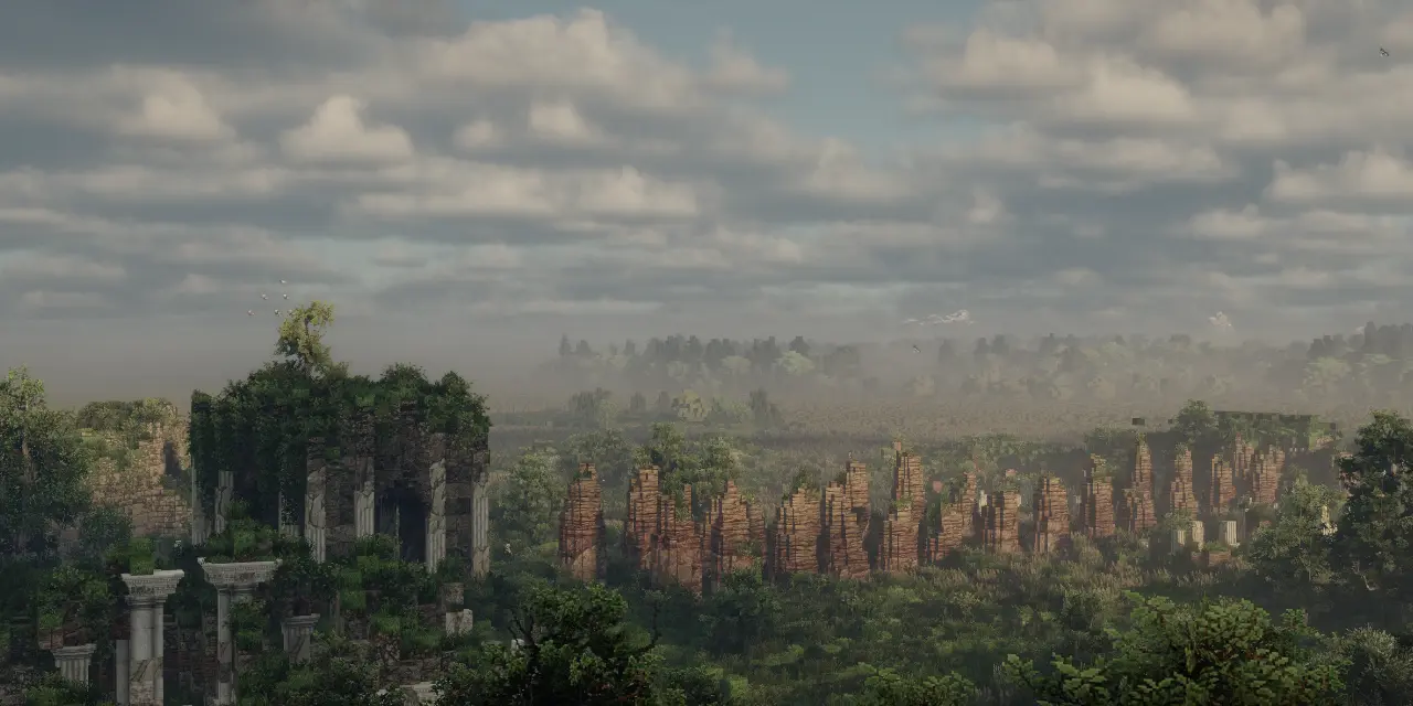
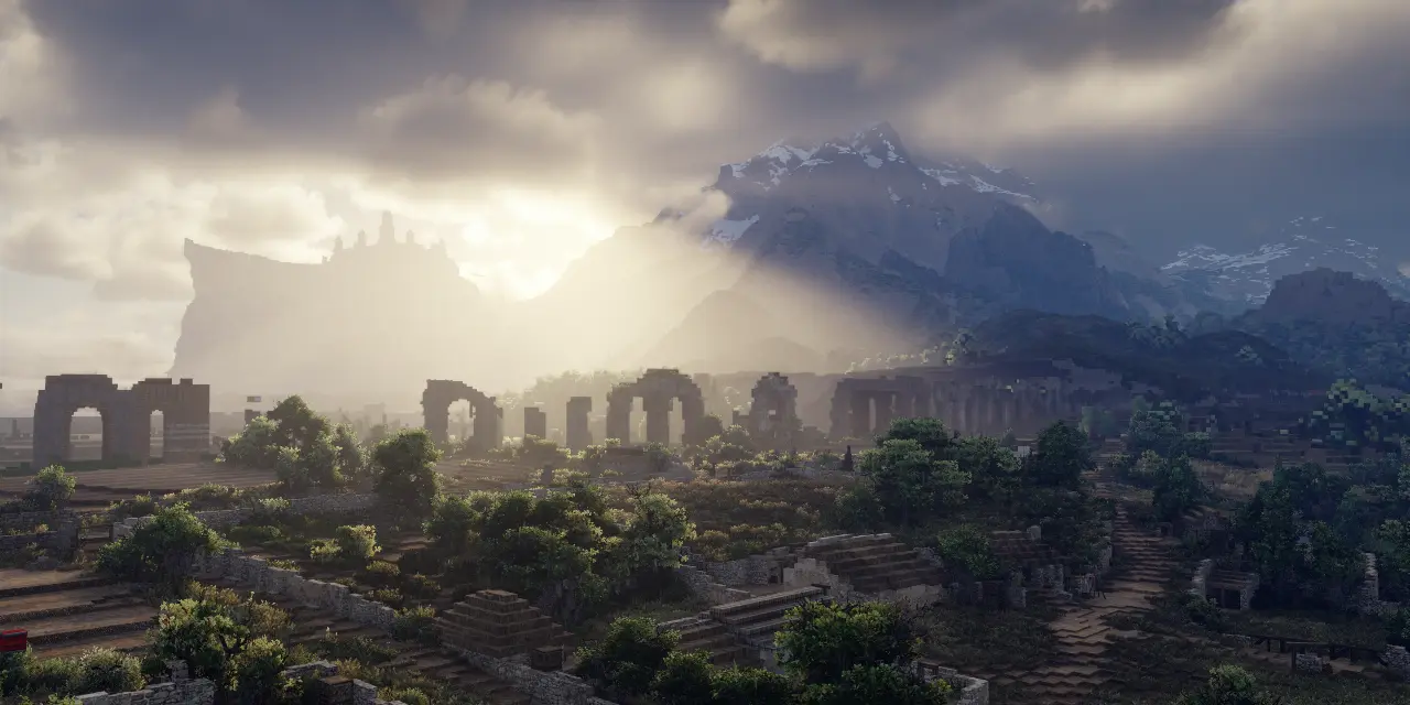
The westernmost region of the kingdom of Rohan, the West-march (or the West Marches) have held a unique position throughout the kingdom's history. Situated on a triangular peninsula between the rivers Isen and Adorn, it is only connected to the rest of Rohan by a small road along the feet of the White Mountains. Its largely isolated position paired with its strong Dunlendic heritage have made its loyalty to the Kings of Edoras dubious throughout the region's history.
This was most notably the case when Wulf, Lord of the West Marches, rebelled against King Helm Hammerhand in T.A. 2758. Together with his Dunlending allies, he invaded the other parts of the kingdom in an attempt to crown himself king. Although he managed to drive King Helm to Helm's Deep and capture Edoras, his rebellion ultimately failed after the Long Winter of T.A. 2759.
He grew rich and powerful, having wide lands on either side of the Adorn. Near its source he made himself a stronghold and paid little heed to the king.
- Appendix A, The Annals of Kings and Rulers
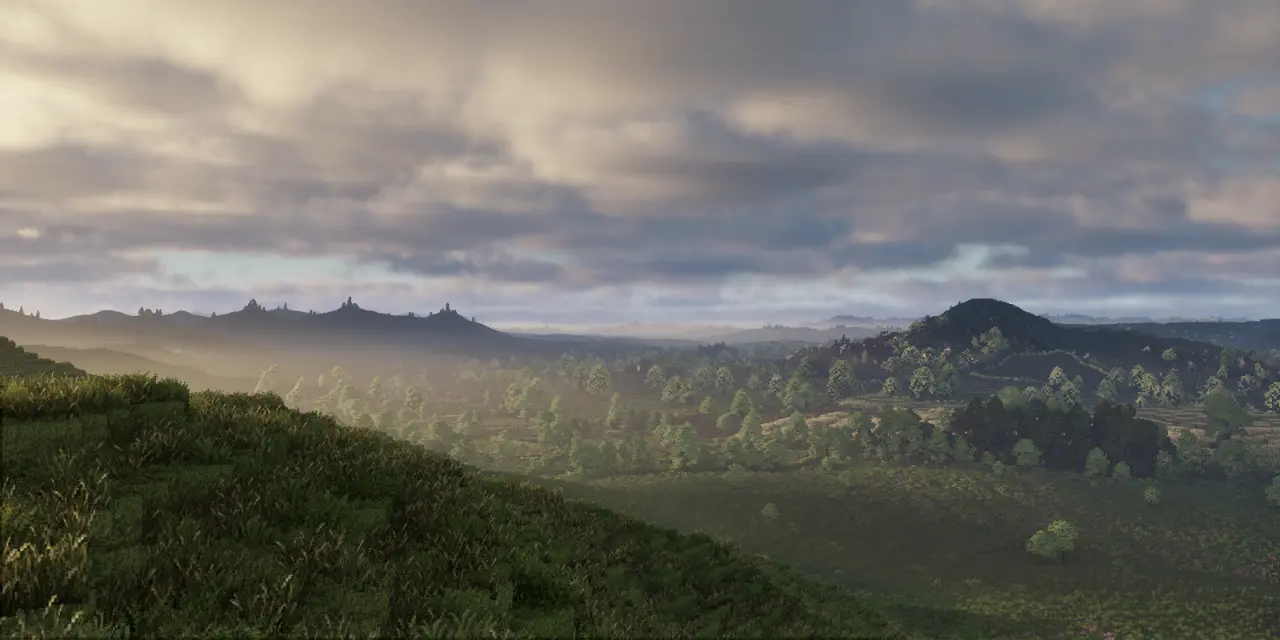
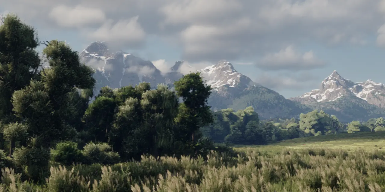
The West-march is the westernmost region of Rohan and its only region west of the White Mountains. It is only accessible by a small road between the river Isen and the feet of the mountains. The largest part of the region is made up of a triangular peninsula between the Isen and the Adorn, the latter of which arises in the mountains on the region's eastern border.
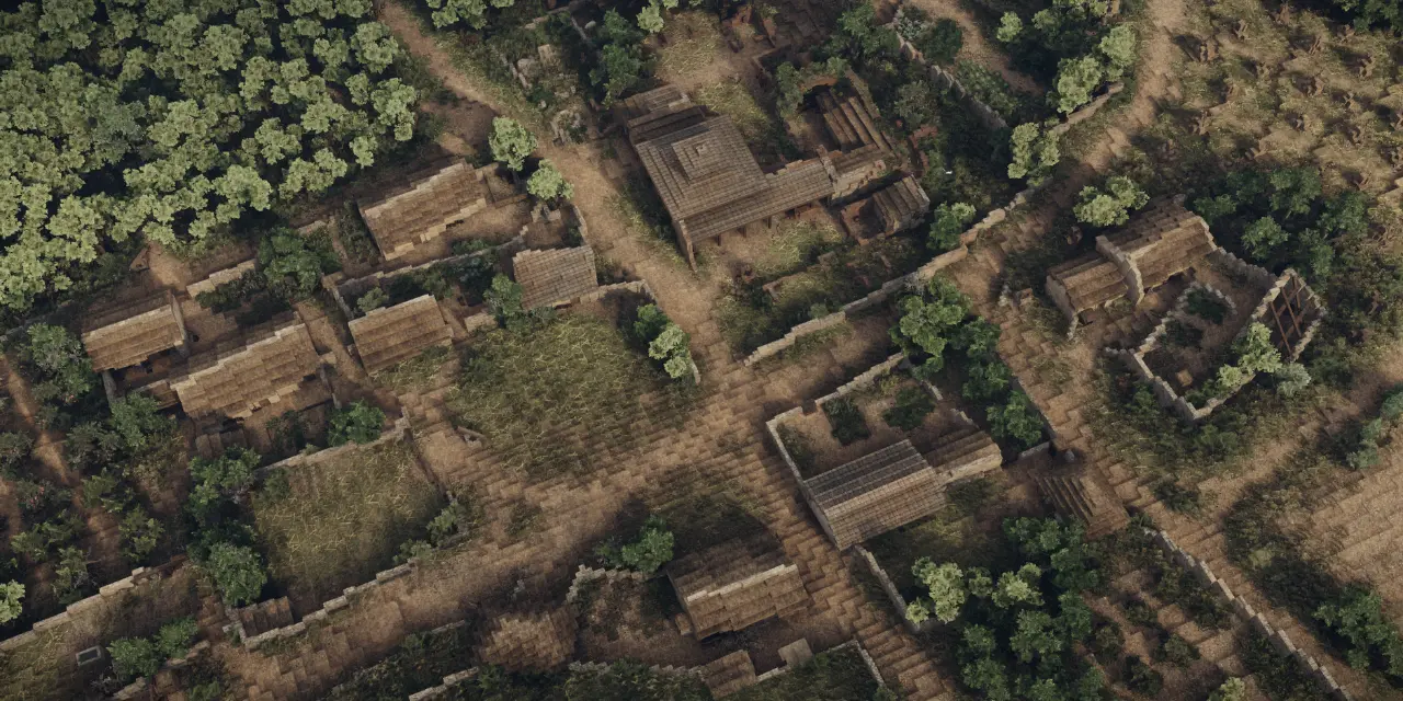
This peninsula can be divided into an eastern and western half. The eastern half consists of a highland, largely covered in forests. It has been settled for many centuries. The lowlands that constitute the region's western half, on the other hand, have only been settled in recent years. The most recent of these settlements is the village of Aberrhyd.
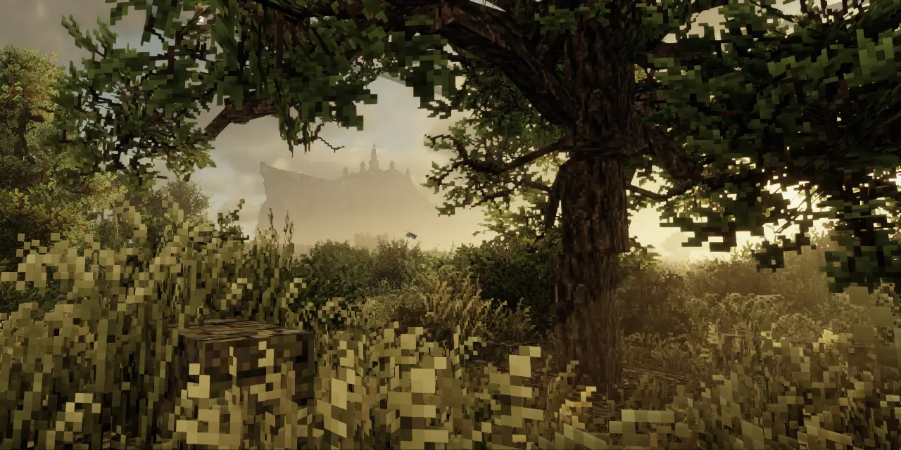
Significant seasonal differences between warm to hot summers and cool to cold winters are the main feature of the region's climate. Both temperatures above 30°C for the summer months and air frosts during winter are common. In addition, the climate is much gloomier than in the regions south of the White Mountains, although less so than in Dunland.
Rainfall is quite heavy compared to other regions of Rohan, although the number of rainy days is relatively moderate. As a result of winter lows averaging below freezing, snowfall also occurs, although the the region's climate is too mild to sustain a snowpack all winter, unlike the surrounding mountains.
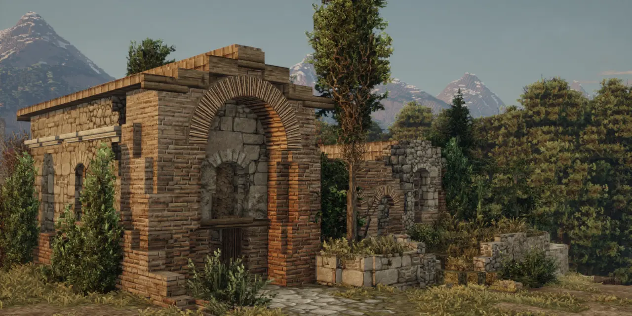
The West-march is ruled by a Thegn (or Thane) sworn to the King of Rohan. The region's isolated position grants its ruler much independence. The Thegn resides in Isenwick and is responsible for the governance and defense of the region. His subjects pay him tribute in the form of produce and other valuables. The current Thegn is Idelgeorn, an old man who has very little interest in governing.
Most of the day-to-day ruling is given to the six Aldermen, powerful men who act as the Thegn's counsel. The most important of these is Ealdwulf, of the lineage of Wulf. A shrewd politician, he has amassed much wealth in recent years and betrothed himself to the Thegn's daughter. Though he resides in Carrdun, he is rebuilding his ancestral fortress in the region's southeast with the help of stonemasons from Isengard.
At the same time Rohan was again invaded from the East, and the Dunlendings seeing their chance came over the Isen and down from Isengard. It was soon known that Wulf was their leader.
- Appendix A, The Annals of Kings and Rulers
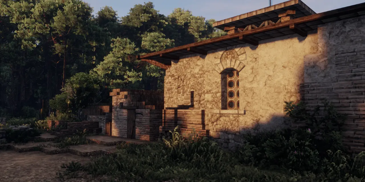
Culturally, the West-march is characterized by its mixed Dunlendic and Rohirric identity. While the eastern parts of the region are more closely tied to Rohan and its culture and customs, the western parts of the region remain mostly Dunlendic. This divide is not only expressed in beliefs and customs but also in architecture. While longhouses are more numerous in the east of the West Marches, its western and southern settlements are almost entirely comprised of Dunlendic roundhouses.
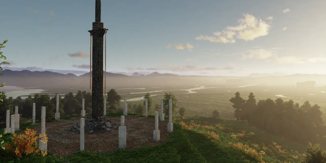
The West-march’s strong connection to Dunland and its people extends to religious beliefs. Similar to the Dunlendings, the people of the West-March believe in a wide pantheon of deities, including some major gods that are common across the land as well as minor, local spirits. There are no direct visual depictions of these deities, only symbolic representations. Druids are the leading religious figures and live in almost every larger West-march settlement. They may have a particular devotion to a local god, but more often they are universal in their practice.
The West-march's mixed cultural identity also impacts its economy whereby it represents a middle ground between the more primitive Dunlendings and the more technologically advanced Rohirrim. The vast majority of the West-march’s inhabitants are farmers and herdsmen. Its industries, such as weaving, woodworking, and tanning are often limited to individual homes and local use.
The region's geographic isolation further limits its possibilities to engage in trade. Although trade with the eastern parts of Rohan remains important, the past conflicts between the two have left their mark. In recent years, trade with Isengard has become more and more prevalent as the wizard Saruman continues to expand his sphere of influence.

The Westfarthing is a region of the Shire. Prominent settlements include Hobbiton, Michel Delving and Tuckborough. The Took and Baggins families reside in the Westfarthing.

The Vale of Anduin comprises the length of the River Anduin from its source in the Grey Mountains to the Wold. It sits in a valley between the eastern foothills of the Misty Mountains and Mirkwood.

The Angle is a region in Eriador. It is situated south of the Trollshaws, before the confluence of the rivers Mitheithel and Bruinen. It is home to the remnants of the Northern Dunedain.

The Southfarthing is the southernmost region of the Shire. It is home to the Sackville Baggins family and is the only region of the Shire warm enough to grow pipe-weed.

Lindon is situated west of the Blue Mountains and is the last remnant of Beleriand. Elves wishing to travel to Valinor must take a ship from the Grey Havens at Mithlond.

Forochel is a region in the far north of Middle-earth. It is inhabited by the Lossoth.

The Far Downs are a group of hills that mark the westernmost border of the Shire. Beyond are the White Towers and Lindon.

The Eastfarthing is a region of the Shire that comprises Woody End, The Marish and the Hills of Scary.

The Westemnet is a flat, marshy region of Rohan to the south of Fangorn forest. Various homesteads can be found here, occupied by herdsmen in the summer months.

Dunland is a region in the western foothills of the Misty Mountains. It is occupied by various tribes, who are often at war with Rohan or each other. They ally with Isengard in the War of the Ring.

The Northfarthing is the northernmost and hilliest region of the Shire. Within it is Greenfields, where the hobbits fought off orcs from Mount Gram. It is the only Farthing of the Shire not to touch the Three Farthing Stone.

Buckland is a region of the Shire between the eastern bank of the Brandywine and the western eaves of the Old Forest. It is under the authority of the Master of Buckland.

Lothlorien is an elven kingdom in a wood of mallorn trees. It is ruled by Galadriel and her husband Celeborn.

Eriador is a vast, mostly unpopulated land between the Misty Mountains and the Blue Mountains. It once contained the Kingdom of Arnor.

Moria, also known as Khazad-dûm, is the ancestral homeland of the Longbeard dwarves under Caradhras. It is currently in ruin, only inhabited by orcs and the Balrog known as Durin's Bane.

The Shire is a region in Eriador inhabited by Hobbits. It was gifted to them by the King of Arnor, and has been their home for over a thousand years.

Mordor is a region surrounded on three sides by mountains. It is home to the Dark Lord Sauron, from which he launches his plans to conquer Middle-earth.

Men first settled in what is now known as Anórien during the First Age, when the Drúedain (or Púkel-men) fled into the region's forests after being hunted by men from the East. While they still linger in these forests today, the region is now occupied by the kingdom of Gondor. In the late Second Age, after the fall of Númenór, the region was given to Anárion as part of the Realms in Exile and was named 'Anórien' after him. Here, Anárion built Minas Anor, the future Minas Tirith.
By T.A. 3006, Anórien was the northernmost fiefdom of Gondor. It has become increasingly deserted due to plagues and the threat from Mordor. Nowadays, Anórien is one of the few fiefs which is still dominated by the Dúnedain of Gondor; specifically, in Minas Tirith and the adjacent townlands where Sindarin is still known and used as a daily language.
Access the full website, chat on our Discord server, and help fund development.
Hobbit
0 days
Orc
0 days
Dwarf
0 days
Man
0 days
Elf
0 days